
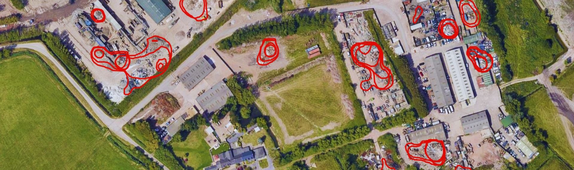
Detecting illegal landfills with 90% accuracy thanks to Artificial Intelligence and satellites: this is the innovative technology developed by a team of researchers from the Department of Electronics, Information and Bioengineering – Politecnico di Milano. Already operational in several European countries, the system accelerates environmental investigations, enhancing efforts to combat environmental crime and protect the land.
The team, led by Prof. Piero Fraternali and Prof. Giacomo Boracchi, has developed an advanced solution for analysing satellite imagery capable of identifying illegal landfills and waste disposal sites with over 90% accuracy.
The PERIVALLON project, funded by the Horizon Europe program, involves 24 partners from 12 EU and non-EU countries, including Fondazione SAFE, ARPA Lombardia, and the Environmental Unit of the Carabinieri. Thanks to collaboration with environmental agencies and law enforcement, this technology is already being used for large-scale land monitoring.
At the heart of the innovation is the use of neural networks and advanced algorithms to analyze satellite images and detect hazardous waste deposits hidden in urban, industrial, and agricultural areas. One of the project’s key tools is the public dataset AerialWaste—the first of its kind in the world—which has already been downloaded over 6,500 times by international researchers.
A pilot study conducted with ARPA Lombardia across more than 100 municipalities showed that the use of Artificial Intelligence significantly reduces investigation times, allowing for quicker interventions and the prevention of irreversible damage to the ecosystem and public health.
This past April, the PERIVALLON project partners met in Soave (VR) for a plenary meeting to assess technological progress and coordinate upcoming activities. On that occasion, two pilot demonstrations were carried out at the training and exercise centre on Monte Calvarina, coordinated by ARPA Lombardia and Fondazione SAFE. The tests allowed for the evaluation of AI solutions developed by the Politecnico di Milano team to analyse both satellite images and images captured by drone flyovers. In both cases, various types of waste—intentionally placed for the demonstration and later removed—were successfully identified.