
Augmented reality to recognize the mountains. The story of the PeakLens app, created by a team of researchers and students from the Department of Electronics, Information, and Bioengineering (DEIB), led by prof. Piero Fraternali, starts from an apparently simple idea. The project recently won the first European prize as "Most Popular App" in the international contest of Huawei "HMS App Innovation".
The apps in the competition were evaluated both through a technical judgment by a jury of experts and thanks to a vote from the international public.
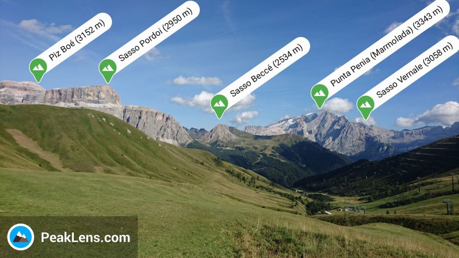
Using PeakLens is intuitive: by framing the profile of a mountain or a mountain range, the app shows the characteristics of the visible peaks in real-time. From the name to the altitude, up to the distance from the observer. This apparently simple function actually hides a high degree of technical complexity. For this PeakLens uses a sophisticated image analysis algorithm based on artificial intelligence, capable of extracting the profile of the mountains visible from the camera frame in a few thousandths of a second. This profile is immediately compared with a 3D digital model of the terrain of the entire planet and then allows to identify the visible peaks.
The app, available on the Android stores and on the Huawei AppGallery, is completely free and ad-free and encourages mountain lovers to actively contribute to the enrichment of Open Street Map, the open-source system of digital cartography, with the aim of promote the love for the mountains and the culture of environmental conservation. Released to the public in 2017, PeakLens' popularity has grown considerably and has so far garnered over 800,000 downloads worldwide.